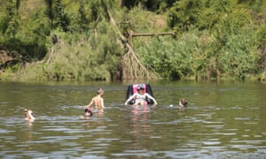
Parts of Western Sydney reached 47C on Saturday, including Penrith, which experienced its hottest day on record
Firefighters are warning Sunday will present an unprecedented fire danger for New South Wales, as the prolonged heatwave creates conditions worse than Black Saturday.
The heatwave across south-east Australia continued to break records on Saturday. Parts of Western Sydney reached 47C on Saturday afternoon, including Penrith, which experienced its hottest day on record.
The outback town of White Cliffs, in NSW’s north-west, broke the record for the hottest minimum overnight temperature. Residents endured a stifling night with a low of only 34.2 degrees.
Canberra recorded its second consecutive 40-degree day for only the third time in its history, while Sydney’s Observatory Hill broke the record for the longest-running spell of days above 35C, which now sits at 10.
The heat wave centred around the greater Hunter region, where temperatures pushed past 46 degrees in many areas.
South Australia’s northern regions and Queensland’s south were also caught in the heatwave.
Energy supplier AGL again curtailed electricity use at Newcastle’s Tomago aluminium smelter to avoid blackouts, the second time in as many days it has taken such drastic action.
Three-hundred firefighters were kept busy across NSW, and thousands more were on standby. By mid-afternoon on Saturday, they were fighting 49 fires burning across the state, with 17 out of control. But authorities have warned the worst is yet to come.
Large areas of the state will be rated as having a catastrophic fire danger on Sunday. That will include the greater Hunter region, the north-western region and the central ranges.
The NSW rural fire service commissioner, Shane Fitzsimmons, said the severity of the conditions on Sunday could not be understated. He said conditions were worse than those on Black Saturday in 2009, which claimed 173 lives and has been described as one of Australia’s worst peacetime disasters.
“We haven’t seen this in NSW to this extent, ever,” Fitzsimmons said. “This is as bad as it gets, it is an awful prognosis heading into the weekend,” he said.
Until recently, the fire danger rating scale was only indexed to a maximum of 100. On Sunday, some areas of NSW will have a fire danger rating of more than 150.
“The conditions for Sunday are the worst possible conditions when it comes to fire danger ratings, they are catastrophic, they are labelled catastrophic for a reason,” Fitzsimmons said. “They are rare, they are infrequent, and to put it simply, they are off the old conventional scale.”
Temperatures are expected to drop in parts of Sydney, but will remain above 40C in parts of the Hunter, the north-west, the mid-north coast, and the northern rivers. Late showers may bring cool relief to some parts of the state toward the end of the day.
The NSW emergency services minister, Troy Grant, urged residents to keep hydrated and to visit shopping centres, cinemas or other cool areas. “Please, with the known catastrophic weather events, if you don’t need to be in dangerous areas, bushfire-prone areas, isolated areas, please don’t be there,” he said.
“Please use your common sense, listen to the messages of the government, that each of our agencies are issuing.”
The dangerous conditions have been created by a combination of heavy rainfall in the winter, which has boosted fuel loads, and high pressure over the country, which has prevented rain-bearing systems from providing relief.
At the same time a cold front from the south is causing the acceleration of north-west to northerly winds. Those winds are drawing in hot and dry air from the centre of the country, creating a huge hot air mass over the state. The NSW Bureau of Meteorology acting regional director, Stephen Lellyett, said he expects further records to be broken in coming days.
In Western Australia, flood warnings were issued in the Wheatbelt and South West regions. Flooding had already caused havoc in the regions, prompting emergency services to call for residents to evacuate in parts of Northam, about 100km east of Perth.
Water levels within the Avon River catchment are expected rise over the weekend with up to 70mm of rain recorded in the 24 hours to Friday night, BoM says.
Flooding hit the community of Toodyay, along Stirling Terrace, and Mortlock River East at O’Driscolls Farm on Saturday morning. Moderate flooding was also expected along the river in Beverley, with water under the town’s bridge at 1.75m and rising.
Residents in Northam were also told to expect minor flooding with some already deciding to head to higher ground.
With AAP
The heatwave across south-east Australia continued to break records on Saturday. Parts of Western Sydney reached 47C on Saturday afternoon, including Penrith, which experienced its hottest day on record.
The outback town of White Cliffs, in NSW’s north-west, broke the record for the hottest minimum overnight temperature. Residents endured a stifling night with a low of only 34.2 degrees.
Canberra recorded its second consecutive 40-degree day for only the third time in its history, while Sydney’s Observatory Hill broke the record for the longest-running spell of days above 35C, which now sits at 10.
The heat wave centred around the greater Hunter region, where temperatures pushed past 46 degrees in many areas.
Energy supplier AGL again curtailed electricity use at Newcastle’s Tomago aluminium smelter to avoid blackouts, the second time in as many days it has taken such drastic action.
Three-hundred firefighters were kept busy across NSW, and thousands more were on standby. By mid-afternoon on Saturday, they were fighting 49 fires burning across the state, with 17 out of control. But authorities have warned the worst is yet to come.
Large areas of the state will be rated as having a catastrophic fire danger on Sunday. That will include the greater Hunter region, the north-western region and the central ranges.
The NSW rural fire service commissioner, Shane Fitzsimmons, said the severity of the conditions on Sunday could not be understated. He said conditions were worse than those on Black Saturday in 2009, which claimed 173 lives and has been described as one of Australia’s worst peacetime disasters.
“We haven’t seen this in NSW to this extent, ever,” Fitzsimmons said. “This is as bad as it gets, it is an awful prognosis heading into the weekend,” he said.
Until recently, the fire danger rating scale was only indexed to a maximum of 100. On Sunday, some areas of NSW will have a fire danger rating of more than 150.
“The conditions for Sunday are the worst possible conditions when it comes to fire danger ratings, they are catastrophic, they are labelled catastrophic for a reason,” Fitzsimmons said. “They are rare, they are infrequent, and to put it simply, they are off the old conventional scale.”
Temperatures are expected to drop in parts of Sydney, but will remain above 40C in parts of the Hunter, the north-west, the mid-north coast, and the northern rivers. Late showers may bring cool relief to some parts of the state toward the end of the day.
The NSW emergency services minister, Troy Grant, urged residents to keep hydrated and to visit shopping centres, cinemas or other cool areas. “Please, with the known catastrophic weather events, if you don’t need to be in dangerous areas, bushfire-prone areas, isolated areas, please don’t be there,” he said.
“Please use your common sense, listen to the messages of the government, that each of our agencies are issuing.”
The dangerous conditions have been created by a combination of heavy rainfall in the winter, which has boosted fuel loads, and high pressure over the country, which has prevented rain-bearing systems from providing relief.
At the same time a cold front from the south is causing the acceleration of north-west to northerly winds. Those winds are drawing in hot and dry air from the centre of the country, creating a huge hot air mass over the state. The NSW Bureau of Meteorology acting regional director, Stephen Lellyett, said he expects further records to be broken in coming days.
In Western Australia, flood warnings were issued in the Wheatbelt and South West regions. Flooding had already caused havoc in the regions, prompting emergency services to call for residents to evacuate in parts of Northam, about 100km east of Perth.
Water levels within the Avon River catchment are expected rise over the weekend with up to 70mm of rain recorded in the 24 hours to Friday night, BoM says.
Flooding hit the community of Toodyay, along Stirling Terrace, and Mortlock River East at O’Driscolls Farm on Saturday morning. Moderate flooding was also expected along the river in Beverley, with water under the town’s bridge at 1.75m and rising.
Residents in Northam were also told to expect minor flooding with some already deciding to head to higher ground.
With AAP
No comments:
Post a Comment