Extract from The Guardian
Experts say it’s unusual to see so many places with such high rainfall across such a wide area. But identifying the cause is complicated
The return of another extreme weather crisis so soon has some asking if this is another display of force from the long arm of the climate crisis.Last modified on Mon 22 Mar 2021 20.52 AEDT
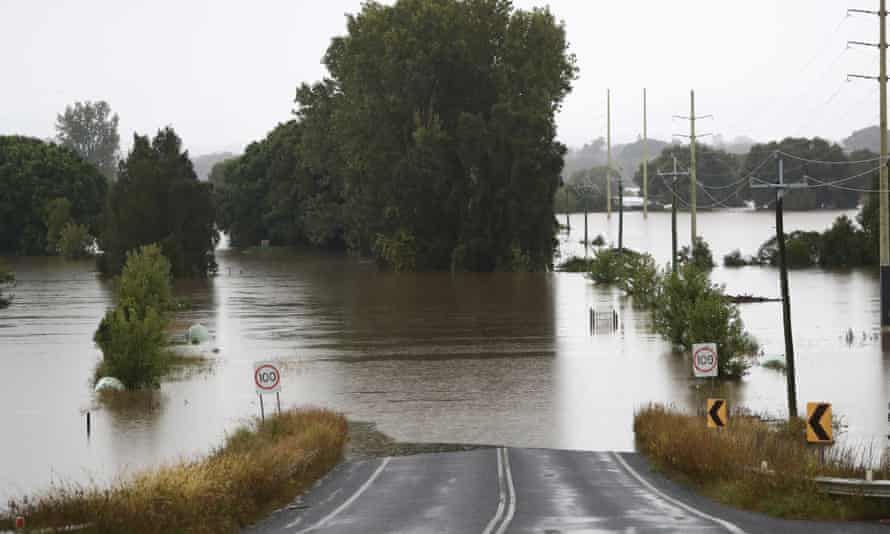
Life-threatening floods have washed away homes and businesses with a deluge of rain inundating hundreds of kilometres of the New South Wales coast.
Falling on already soaked soils, the rains sparked dozens of flood warnings, with residents in parts of Sydney’s north and west also fearing for their homes and their lives.
The floods come a little over a year after the same areas were ablaze from unprecedented bushfires fueled by global heating that burned entire towns and killed billions of animals.
The return of another extreme weather crisis so soon has some asking if this is another display of force from the long arm of the climate crisis. The answer is a complex and nuanced one.
How wet has it been?
The extreme rainfall came after three weather systems combined, the Bureau of Meteorology has said.
A tropical low over the Kimberley coast in Western Australia drove moisture across the continent, hitting a coastal trough off the east coast. Further east in the Tasman sea, an area of stationary high pressure was holding the rain event in place.
Senior climatologist at the bureau Dr Blair Trewin is still crunching the rainfall numbers from recent days, but he says two things stand out.
While it is not unusual to have places with very high daily rainfall totals, it is unusual to see so many places with such extreme totals across such a wide area.
“Really the only area that’s missed out is the south coast so far,” he said, adding even that area is predicted to get good rainfall by the middle of the week.
He said the daily rainfall totals seen in some areas of the mid-north coast were not, on their own, unusual.
The highest reading of 406mm in one day fell near Kendall, south of Port Macquarie, on 20 March. But Trewin said in five of the last 12 years, a location in that area had recorded similar totals.
The highest so far was at Comboyne, west of Port Macquarie, that saw 843mm in the four days up to 9am on Monday morning.

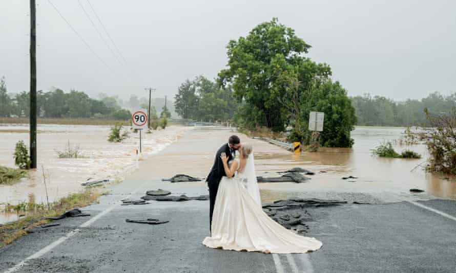
Kate Fotheringham and Wayne Bell on their wedding day on Gloucester Road Wingham. Photograph: Amanda Hibbard
Trewin said he was seeing numerous sites with four-day drenchings above 600mm.
The bureau was still analysing the data, but Trewin said there were other unusual factors to the event.
While a La Niña weather pattern is generally associated with wetter-than-average conditions, he said usually this had more impact in inland areas of NSW, not all the way along the coastline.
So what about climate change?
Whenever Australia experiences extreme weather events, the inevitable question arises: was this caused by climate change?
Some climate scientists will argue all weather events are influenced by human activity because we’ve rapidly changed the composition of the atmosphere.
Burning fossil fuels and deforestation has increased the amount of climate-warming CO2 in the atmosphere by about 50% since the start of the industrial revolution.
And while the rainfall totals experienced over recent days are not yet confirmed as record-breaking, this does not mean that climate heating has had no effect at all.
Professor Steve Sherwood, of the Climate Change Research Centre at the University of New South Wales, says that basic physics shows a warmer atmosphere can hold more moisture – about 7% for each degree of warming.
“So we know that something like 5-10% of the rain we are getting now [in the current downpours] is from global warming and the rest would have happened anyway.
How much extra rain could climate warming deliver?
As some climate scientists have said in relation to previous extreme events, a question that gets us closer to understanding what’s going on is how might climate heating have made an event worse than it would otherwise have been?
Australia’s latest State of the Climate report, released in 2020, says there has already been an increase in the intensity of heavy rainfall events in Australia. More warming will make things worse in the future, the report says.
One study Sherwood helped to carry out has suggested that 2C of warming in Australia could add between 11% and 30% more rain to the heaviest daily downpours.
Australia has already warmed by about 1.4C.
Climate scientists carry out formal studies and have them peer-reviewed before they’re willing to say how climate heating has affected individual events.
But these “attribution studies” are especially challenging when it comes to rainfall because of all the different factors that can influence the systems that deliver rain.
One study on the 2010/11 floods in the north-east of Australia found the extra heat in the oceans had likely increased the amount of rain that fell. A study of extreme rainfall in the south-east of the country the following year failed to detect any human influence.
Extracting
the fingerprint of human influence amid all that noise is a major
challenge, says Dr Michael Grose, a climate projections scientist at
CSIRO.
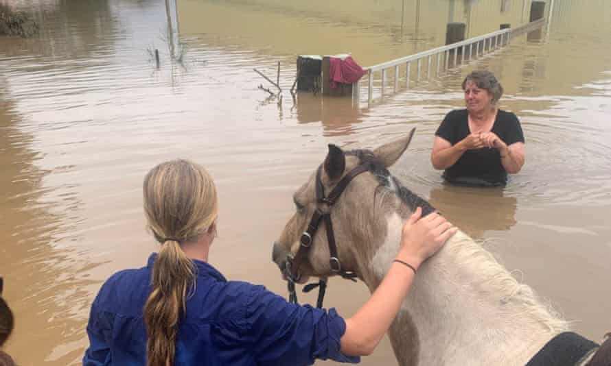
13 year old Ella Saul has braved the floodwaters on horse back to help save her family’s cows. 85 of Gavin Saul’s cattle were swept away in Kempsey, NSW. Photograph: Gavin Saul
He said climate change could also be affecting the frequency of the weather systems that tend to deliver downpours, but this was “trickier to get at”.
He said: “The effect of climate change on the dynamics of the kind of weather patterns bringing the current flooding rains, including the high in the Tasman Sea and troughs creating ‘atmospheric rivers’, is a subject of ongoing research. It may be that this influence offsets or enhances the first effect.”
What about that one-in-100-years flood?
The NSW premier, Gladys Berejiklian, has said the mid-north coast is facing a “one-in-100-year event”.
Describing extreme flood events in this way – as the probability of an event happening in a given timeframe – is common but potentially misleading, argues Thomas Mortlock, a senior risk scientist at Risk Frontiers – a risk management and catastrophe modelling consultancy.
“We really need to get away from that terminology,” he said.
“People think that if it’s a one-in-100 year flood, that the chances of them experiencing that in their lifetime is practically zero. And it’s not.”
He said it is entirely possible to get three or four “one-in-100-year floods” coming along in close proximity.
Often, he said, these statements were based on incomplete data and were calculated presuming that other factors – such as flood mitigation or the climate – were stationary, which they are not.
“We need instead to talk about the probability of an event happening each year, or say, within the life of a mortgage,” he said.
In an unpublished briefing prepared by Risk Frontiers before the current floods, Mortlock writes: “To generalise, if you’ve experienced a large natural hazard event yesterday, it doesn’t necessarily lessen the chance of you experiencing the same or higher magnitude event tomorrow.
“You’re not safe for another 100 years if you’ve just been flooded by the 100-year event today.”
Andrew Gissing, a general manager at Risk Frontiers and an emergency management expert with the Bushfire and Natural Hazards CRC, said it had been long known that Sydney’s Hawkesbury and Nepean rivers often flooded (the New South Wales governor general Lachlan Macquarie wrote to settlers in 1817 warning them of the flood risk in that area.)
“Floods in Australia are more damaging than bushfires and they kill more people in the historical record. They are often an under-appreciated hazard,” Gissing said.
Climate heating was adding urgency to the need to improve flood mitigation, he said, and the current floods should add focus to actions like building flood levees, raising houses, voluntary acquisition of homes in at-risk regions or raising dams and weirs.
“The more we can invest in flood mitigation, the better,” he said.

.png)
No comments:
Post a Comment