Extract from The Guardian
Cloud measured 1,000km across, travelled 66,000km and was on par with ‘strongest volcanic eruptions in the past 25 years’, scientists say

Last modified on Tue 3 Nov 2020 03.32 AEDT
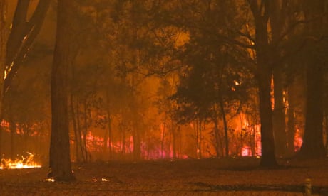
Smoke cloud pushed into the stratosphere by last summer’s bushfire crisis was three times larger than anything previously recorded globally, according to research by international scientists.
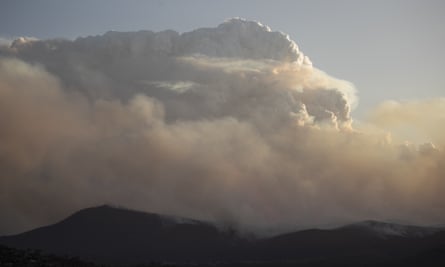
Researchers from Canada’s University of Saskatchewan used Nasa satellite information to measure smoke in the upper atmosphere in the aftermath of pyrocumulonimbus storms (PyroCBs), which are fire-generated thunderstorms.
They found the cloud caused by Australia’s bushfires measured 1,000km across, remained intact for three months, travelled 66,000km and “soared to a height of 35km above earth”.
The 2019-20 bushfire crisis was a standout year for PyroCB storms, with 20 such storms recorded, more than any previous Australian fire season.
The report from the bushfire royal commission, handed down on Friday, found it was likely there would be an increase in dangerous pyro-convection events for many regions in southern Australia in future fire seasons due to climate change.
PyroCBs create powerful updrafts that push smoke and air into the upper part of the atmosphere, known as the stratosphere.
The university researchers found the smoke cloud created by the Australian fires exceeded the previous record created by the 2017 Canadian wildfires and was “on par with the strongest volcanic eruptions in the past 25 years”.
“When I saw the satellite measurement of the smoke plume at 35km, it was jaw-dropping. I never would have expected that,” said Adam Bourassa, a professor of physics and the study’s lead author.
Bourassa said aerosols – such as smoke from fires or sulphuric acid from a volcanic eruption – could remain aloft for months and blocked the passage of sunlight. He said the Australian fires blocked sunlight to an extent not previously seen from fires.
“We’re seeing records broken in terms of the impact on the atmosphere from these fires,” he said. “Knowing that they’re likely to strike more frequently and with more intensity due to climate change, we could end up with a pretty dramatically changed atmosphere.”
The researchers plan to compare their findings in relation to Australia with data captured from the recent Californian fires.
Jason Sharples, of the University of New South Wales, said he was not surprised the research had found record-breaking levels of stratospheric smoke as a result of the Australian fire season.
“We had more (PyroCB) events and more of those were highly energetic events, so you’re more likely to get into those heights,” he said. “I suspect they’ll find some similar things from the western US when they have a look.”
Andrew Dowdy is a senior research scientist at the Bureau of Meteorology who studies PyroCBs.
He said fire-generated thunderstorms would increase in southern Australia due to carbon emissions. Research by the bureau that examined historical records back to 1979 had found that environments conducive to PyroCBs forming were already more common.
“Fire-generated thunderstorms can create strong and erratic winds that lead to dangerous fire behaviour and they can also create lightning that can generate new fires ahead of the fire front,” he said.

He said the bureau was also working with state fire agencies and research partners to trial new long-range fire predictors it had developed. Previously, its long-range fire outlooks considered temperature and rainfall indicators.
Dowdy said new predictors being trialled combined rainfall, humidity, wind speed, temperature and relative fuel moisture to predict the fire outlook up to four months ahead.
He said it was “experimental research” but if successful could help guide decisions about resources such as crew deployment or hiring of waterbombing aircraft and give agencies greater ability to plan for fire seasons.
No comments:
Post a Comment